Area Code Boundaries

GeoTel’s Area Code Boundaries dataset features polygons for U.S. Area Codes. This dataset provides essential insights for defining coverage, customer location, call volume analysis, and network planning.

U.S. Geographic Insight

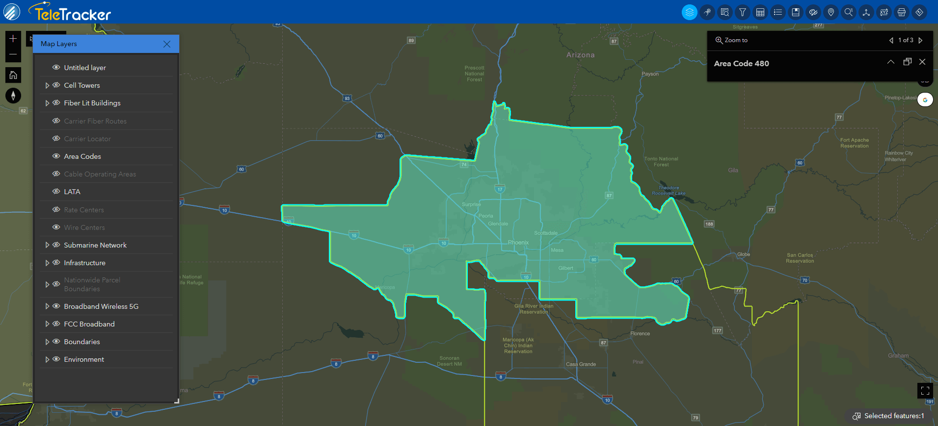
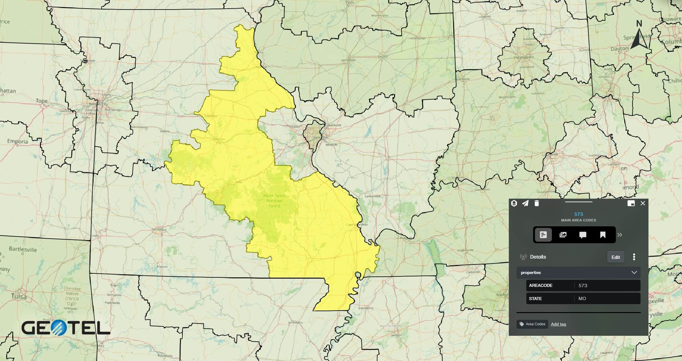
GeoTel’s Area Code Boundaries dataset includes polygons representing the geographic coverage of U.S. Area Codes—the first three digits of a 10-digit U.S. phone number (NPA/NXX). These boundaries serve as a fundamental method for identifying coverage areas. This data is available for the entire United States or by individual states.

U.S. Geographic Insight
Area Code Boundaries

How Area Code Boundaries Can Be Used

An Area Code Boundary is used for network planning purposes in telecommunications. This dataset determines the geographical customer base and areas of service. GeoTel’s Area Code Boundaries dataset provides crucial insights into U.S. Area Codes, enabling a precise definition of coverage areas, customer location identification, call volume analysis, and strategic network planning. Request a demo today to unlock the potential of Area Code Boundaries in enhancing your telecommunications strategy.

Benefits

  • Gain insights into the coverage areas of specific area codes
  • Identify customer locations based on area code boundaries
  • Analyze call volumes in relation to area code boundaries
  • Optimize network planning by leveraging area code insights

Area Codes Boundaries Available in GIS & SaaS

[dipl_image_card_carousel equalize_slides_height=”on” slider_loop=”on” autoplay=”off” show_arrow=”on” previous_slide_arrow=”4||divi||400″ next_slide_arrow=”5||divi||400″ cards_per_slide_tablet=”3″ cards_per_slide_phone=”3″ cards_per_slide_last_edited=”on|phone” _builder_version=”4.27.4″ _module_preset=”default” hover_enabled=”0″ global_colors_info=”{}” sticky_enabled=”0″][dipl_image_card_carousel_item title=” ” image=”https://www.geo-tel.com/wp-content/uploads/2024/08/Area-Codes_Miami_Community-base_CROPPED-1.png” image_alt=”This image is of the Miami, FL area code (305). This area code is being displayed on the Community base map found within GeoTel’s TeleTracker.” _builder_version=”4.27.0″ _module_preset=”default” global_colors_info=”{}”][/dipl_image_card_carousel_item][dipl_image_card_carousel_item title=” ” image=”https://www.geo-tel.com/wp-content/uploads/2024/08/Area-Codes_Miami_Firefly-Hybrid-base_CROPPED.jpg” image_alt=”This image is an example of GeoTel’s fiber maps that display area code boundaries. This map displays boundaries in South Florida on TeleTracker’s Firefly Hybrid map which uses high-contrast lines and polygons as well as satellite imagery. ” _builder_version=”4.27.0″ _module_preset=”default” global_colors_info=”{}”][/dipl_image_card_carousel_item][dipl_image_card_carousel_item title=” ” image=”https://www.geo-tel.com/wp-content/uploads/2024/08/Area-Codes_Phoenix_Street-Nights-base_CROPPED.png” image_alt=”GeoTel’s TeleTracker displays an area code boundary using high-contrast polygons on the Street Night base map. ” _builder_version=”4.27.0″ _module_preset=”default” global_colors_info=”{}”][/dipl_image_card_carousel_item][dipl_image_card_carousel_item title=” ” image=”https://www.geo-tel.com/wp-content/uploads/2024/08/Area-Codes_Phoenix_Terrain-with-labels_CROPPED.jpg” image_alt=”TeleTracker’s Terrain with Labels base map displays a Phoenix, AZ area code (480). This base map shows and labels geographic features within the selected area. ” _builder_version=”4.27.0″ _module_preset=”default” global_colors_info=”{}”][/dipl_image_card_carousel_item][dipl_image_card_carousel_item title=” ” image=”https://www.geo-tel.com/wp-content/uploads/2024/03/AreaCodes-1.jpg” image_alt=”Area Code Boundaries Image” _builder_version=”4.27.0″ _module_preset=”default” global_colors_info=”{}”][/dipl_image_card_carousel_item][dipl_image_card_carousel_item title=” ” image=”https://www.geo-tel.com/wp-content/uploads/2024/03/AreaCodes-2.jpg” image_alt=”Area Code Boundaries Image” _builder_version=”4.27.0″ _module_preset=”default” global_colors_info=”{}”][/dipl_image_card_carousel_item][dipl_image_card_carousel_item title=” ” image=”https://www.geo-tel.com/wp-content/uploads/2023/12/area-codes011.jpg” image_alt=”Area Code Boundaries Image” _builder_version=”4.27.0″ _module_preset=”default” global_colors_info=”{}”][/dipl_image_card_carousel_item][/dipl_image_card_carousel]

Interested in a Free Live Demo?

Experience firsthand how our comprehensive telecom datasets, advanced analytics, and user-friendly platforms can empower your business.