The telecommunications industry is in high demand for accurate datasets that aren’t solely sourced from artificial intelligence, since AI data isn’t 100% reliable. Instead, they need accurate data from trusted location-based intelligence that aligns with AI, APIs, and spatial data analysis.
Why Geospatial Intelligence Is the Key to Advanced Telecom
Geospatial data includes information with components, such as satellite imagery, fiber maps, and technologies with location-based features. In the telecom industry, geospatial software is evolving from a specialized mapping function into a foundational digital infrastructure that supports both public and private-sector decision-making. Such as interactive 3D maps, 5G towers, carriers, and data centers, to obtain sustainable growth in the digital era. These technologies can be made available through SaaS and APIs.
What’s the Difference Between TeleTracker SaaS and APIs?
First, one may ask, how exactly do APIs work in telecom? Computer software can communicate directly with other software to respond at the speed of light. A telco may ask software for a project: “Which fiber providers serve this building?” Then the software sends a request to a telecommunications API, which returns the building’s fiber availability and carrier names immediately.
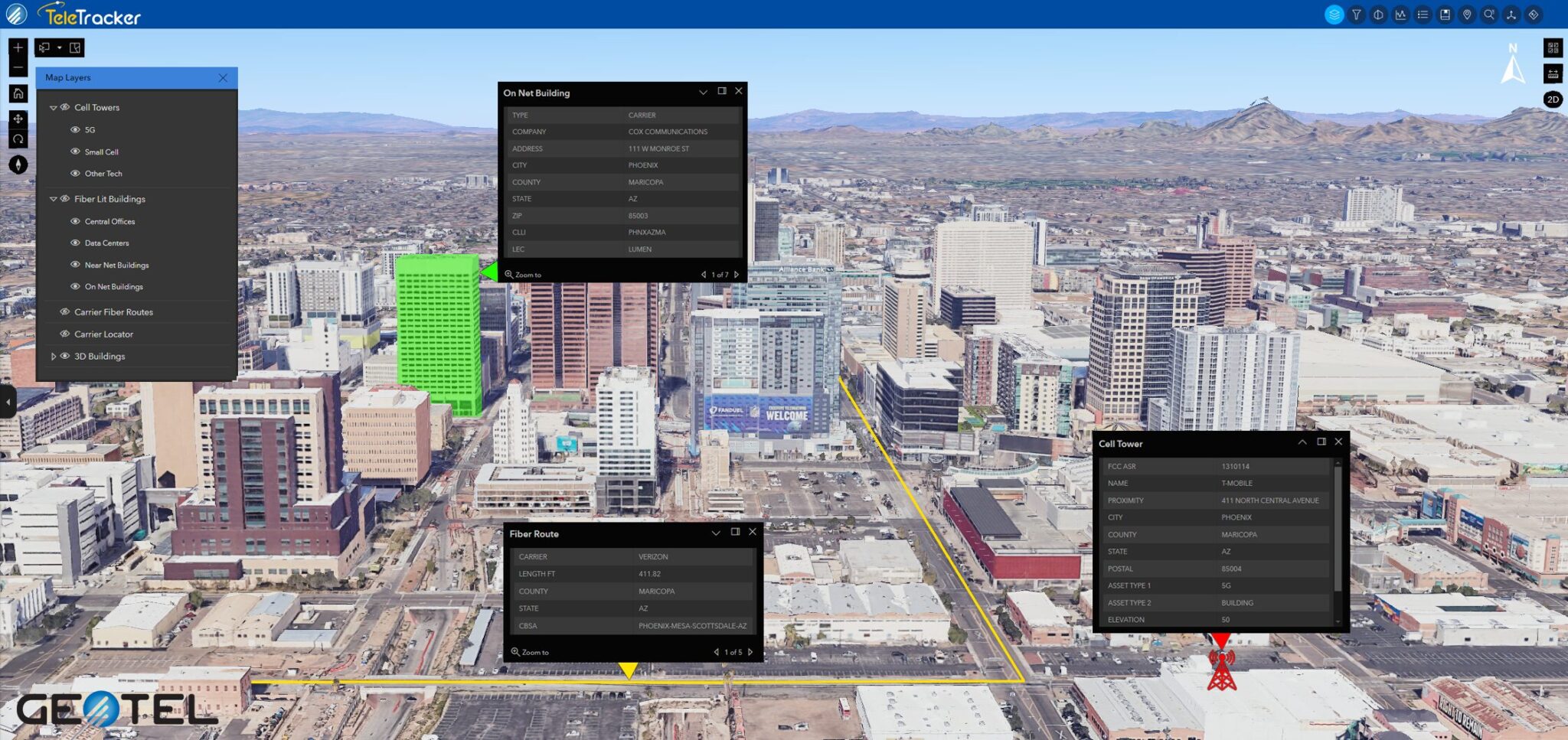
TeleTracker, as a software platform, is the complete package for telcos to get all the location-based data they need about that building. The APIs interact behind the scenes, while TeleTracker displays the data in 3D for the telcos to fully understand those codes visually. These two different delivery methods can then be further optimized with the integration of AI.
How AI Pairs with Geospatial Intelligence
Inevitably, AI is only as good as the human intellect data it learns from. With the emergence of platforms that run machine learning in-database on stacks of records, rather than moving data across systems. Telecoms can now foretell, adjust, and adapt. When AI is applied to geospatial data, it enhances the process and enables more effective evaluation at large scales. Developing conversational geospatial AI agents that facilitate access of non-technical GIS users to data insight. UNIVERSITY PARK, PA states, “The advent of artificial intelligence (AI) as an independent ‘agent’ capable of performing GIS functions with minimal human oversight”. Ultimately, artificial intelligence combining geospatial intelligence is a superb investment for organizations in the modern telecom industry.
Spatial Data Analysis and Network Intelligence
Many industries depend on telecommunications spatial capabilities to travel well. Utilities, real estate, and local city agency teams can source the same spatial context to align efforts with providers and partners. When planners optimize networks with a precise spatial lens, customers see the results in improved connectivity and more reliable service. This strengthens communication with internal stakeholders and external partners. As digital infrastructure continues to advance, the combination of spatial data analysis, AI, and network intelligence is helping organizations make faster, more informed decisions about telecommunications infrastructure, fiber connectivity, and network planning.
Why Should Enterprises Utilize Teletracker
Time is as valuable as gold in today’s fast-paced society. Organizations cannot afford to spend precious time waiting for carrier responses. These vital answers are instantly available with TeleTracker! GeoTel’s TeleTracker assists enterprises seeking to leverage precise, up-to-date data for operational, financial, and network planning needs. Schedule a demo to learn more!