
A Decline in BEAD Eligibility Signals the Program’s Current Success

Using GIS in Agricultural Project
There is no doubt that the United States is the agricultural superpower of the world. We probably have one of the best food production and distribution systems in the entire world; in fact, it is the envy of many governments around the world. The use of GIS...
Collecting Big Data for GIS
In the world of GIS, there is one fact that is going to remain for the next few decades: the datasets which are being collected for both commercial and academic purposes are only going to get larger. In fact, it will become so large that it will now be termed as “Big...

Telecom Revenues On the Rise in 2017
In one of our previous blog postings, we visited the topic of the rural farmlands as a huge boon to the telecom vendors here in the United States. As we embark on 2017, there is yet another new market that this industry should be looking at Business services. Of...

Optical Clock Tested in Space
In our previous postings, we have covered many interesting and very imaginative applications that are unique to the GIS world. Today, we explore an even more innovative idea: the Atomic Clock. But, what exactly is it? According to Wikipedia, it can be defined as “ ....
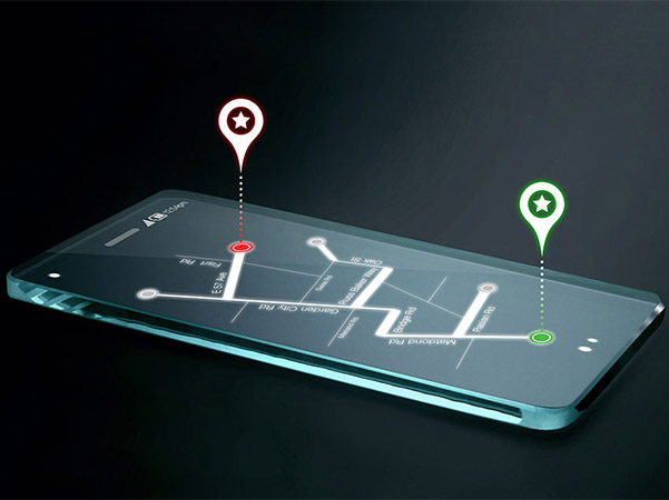
OS Sets Out to Create Road-Map of Britain
When we think of GIS apps (especially those mobile ones), the thoughts of seeing maps with many highways and roads immediately comes to mind. Even “talking” maps are available, where the app will literally talk you through how to get from Point A to Point B. In a...

Assessing the Risk of UAV’s and Air Traffic
Just recently, we wrote about the benefits of using Unmanned Aerial Vehicles (UAVs) and other unpiloted drones in GIS research. Essentially, these specialized aircraft can go into areas and the most desolate reaches of Earth (where no human can go) in order to take...
Telecom Outages Present in California
In one of our previous blog postings, we wrote about what we would feel if our Smartphone were either lost or stolen. Obviously, a feeling of paralysis would be the first emotion that would literally sink in. The reason for this is that as a society has become so...
SuperGIS Server 3.3
In the world of GIS, there is no doubt that a lot of information and data is not just stored, but it is also used. In fact, all types and kinds of data sets are fed into systems on a constant, 24 X 7 X 365 basis. But, you may be wondering, just exactly where is all of...
GIS Apps Are Making Lives Enjoyable
In today’s world, we are connected to our Smartphone literally at the hip. It has become an extension of both our personal and professional lives. In fact, there are some jobs now where we don’t even have to go to the office anymore. All the work can be done from...